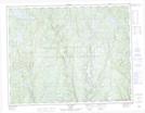
Maps showing Rivière Dure au Gel, Lac-Walker; Sept-Rivières, Quebec
Rivière Dure au Gel is a River located in Lac-Walker; Sept-Rivières, Quebec.
- Latitude: 50° 44' 25'' North (decimal: 50.7402778)
- Longitude: 67° 18' 56'' West (decimal: -67.3155555)
- Topography Feature Category: River
- Geographical Feature: Rivière
- Canadian Province/Territory: Quebec
- Location: Lac-Walker; Sept-Rivières
- Atlas of Canada Locator Map: Rivière Dure au Gel
- GPS Coordinate Locator Map: Rivière Dure au Gel Lat/Long