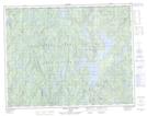
Maps showing L'Écumante, Lac-Walker; Sept-Rivières, Quebec
L'Écumante is a Cape located in Lac-Walker; Sept-Rivières, Quebec.
- Latitude: 50° 48' 34'' North (decimal: 50.8094444)
- Longitude: 67° 9' 32'' West (decimal: -67.1588889)
- Topography Feature Category: Cape
- Geographical Feature: Pointe
- Canadian Province/Territory: Quebec
- Location: Lac-Walker; Sept-Rivières
- Atlas of Canada Locator Map: L'Écumante
- GPS Coordinate Locator Map: L'Écumante Lat/Long
L'Écumante NTS Map Sheets