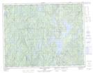
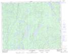
Maps showing Ruisseau de Plein Vent, Lac-Walker; Sept-Rivières, Quebec
Ruisseau de Plein Vent is a River located in Lac-Walker; Sept-Rivières, Quebec.
- Latitude: 50° 59' 39'' North (decimal: 50.9942072)
- Longitude: 66° 57' 52'' West (decimal: -66.9643764)
- Topography Feature Category: River
- Geographical Feature: Ruisseau
- Canadian Province/Territory: Quebec
- Location: Lac-Walker; Sept-Rivières
- Atlas of Canada Locator Map: Ruisseau de Plein Vent
- GPS Coordinate Locator Map: Ruisseau de Plein Vent Lat/Long
Ruisseau de Plein Vent NTS Map Sheets