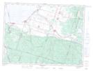
Maps showing Mont Hudon-Beaulieu, Hébertville; Lac-Saint-Jean-Est, Quebec
Mont Hudon-Beaulieu is a Mountain located in Hébertville; Lac-Saint-Jean-Est, Quebec.
- Latitude: 48° 19' 52'' North (decimal: 48.3311111)
- Longitude: 71° 41' 1'' West (decimal: -71.6836111)
- Topography Feature Category: Mountain
- Geographical Feature: Mont
- Canadian Province/Territory: Quebec
- Location: Hébertville; Lac-Saint-Jean-Est
- Atlas of Canada Locator Map: Mont Hudon-Beaulieu
- GPS Coordinate Locator Map: Mont Hudon-Beaulieu Lat/Long
Mont Hudon-Beaulieu NTS Map Sheets