Maps showing Mont Cook, Baie-Obaoca; Matawinie, Quebec
Mont Cook is a Mountain located in Baie-Obaoca; Matawinie, Quebec.
- Latitude: 47° 43' 31'' North (decimal: 47.7253466)
- Longitude: 74° 40' 5'' West (decimal: -74.6679232)
- Topography Feature Category: Mountain
- Geographical Feature: Mont
- Canadian Province/Territory: Quebec
- Location: Baie-Obaoca; Matawinie
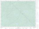
- Atlas of Canada Locator Map: Mont Cook
- GPS Coordinate Locator Map: Mont Cook Lat/Long
Mont Cook NTS Map Sheets