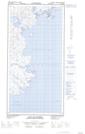
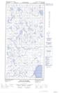
Maps showing Passe Ammaluttuup Qamaninga, Rivière-Koksoak; Kativik, Quebec
Passe Ammaluttuup Qamaninga is a Channel located in Rivière-Koksoak; Kativik, Quebec.
- Latitude: 60° 43' 9'' North (decimal: 60.7190900)
- Longitude: 69° 42' 50'' West (decimal: -69.7137728)
- Topography Feature Category: Channel
- Geographical Feature: Passe
- Canadian Province/Territory: Quebec
- Location: Rivière-Koksoak; Kativik
- Atlas of Canada Locator Map: Passe Ammaluttuup Qamaninga
- GPS Coordinate Locator Map: Passe Ammaluttuup Qamaninga Lat/Long
Passe Ammaluttuup Qamaninga NTS Map Sheets