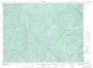
Maps showing Lac Meilleur, Lac-Oscar; Antoine-Labelle, Quebec
Lac Meilleur is a Low vegetation located in Lac-Oscar; Antoine-Labelle, Quebec and has an elevation of 424 meters.
- Latitude: 46° 54' 13'' North (decimal: 46.9036111)
- Longitude: 74° 53' 20'' West (decimal: -74.8888888)
- Topography Feature Category: Low vegetation
- Geographical Feature: Marais
- Canadian Province/Territory: Quebec
- Elevation: 424 meters
- Location: Lac-Oscar; Antoine-Labelle
- Atlas of Canada Locator Map: Lac Meilleur
- GPS Coordinate Locator Map: Lac Meilleur Lat/Long
Lac Meilleur NTS Map Sheets