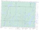
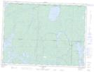
Maps showing Rivière Kânitawigamitek, Val-d'Or; Vallée-de-l'Or, Quebec
Rivière Kânitawigamitek is a River located in Val-d'Or; Vallée-de-l'Or, Quebec.
- Latitude: 47° 46' 31'' North (decimal: 47.7752778)
- Longitude: 77° 39' 11'' West (decimal: -77.6530556)
- Topography Feature Category: River
- Geographical Feature: Rivière
- Canadian Province/Territory: Quebec
- Location: Val-d'Or; Vallée-de-l'Or
- Atlas of Canada Locator Map: Rivière Kânitawigamitek
- GPS Coordinate Locator Map: Rivière Kânitawigamitek Lat/Long
Rivière Kânitawigamitek NTS Map Sheets