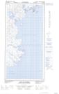
Maps showing Îles Salumaittuq, Rivière-Koksoak; Kativik, Quebec
Îles Salumaittuq is a Island located in Rivière-Koksoak; Kativik, Quebec.
- Latitude: 60° 30' 12'' North (decimal: 60.5032578)
- Longitude: 69° 45' 45'' West (decimal: -69.7624729)
- Topography Feature Category: Island
- Geographical Feature: Îles / Iles
- Canadian Province/Territory: Quebec
- Location: Rivière-Koksoak; Kativik
- Atlas of Canada Locator Map: Îles Salumaittuq
- GPS Coordinate Locator Map: Îles Salumaittuq Lat/Long
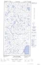
Îles Salumaittuq NTS Map Sheets