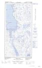
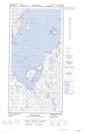
Maps showing Pointe Grave, Rivière-Koksoak; Kativik, Quebec
Pointe Grave is a Cape located in Rivière-Koksoak; Kativik, Quebec and has an elevation of 15 meters.
- Latitude: 60° 49' 28'' North (decimal: 60.8243851)
- Longitude: 69° 53' 57'' West (decimal: -69.8990386)
- Topography Feature Category: Cape
- Geographical Feature: Pointe
- Canadian Province/Territory: Quebec
- Elevation: 15 meters
- Location: Rivière-Koksoak; Kativik
- Atlas of Canada Locator Map: Pointe Grave
- GPS Coordinate Locator Map: Pointe Grave Lat/Long
Pointe Grave NTS Map Sheets