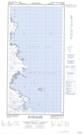
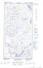
Maps showing Lac Aanalik, Rivière-Koksoak; Kativik, Quebec
Lac Aanalik is a Lake located in Rivière-Koksoak; Kativik, Quebec.
- Latitude: 60° 17' 52'' North (decimal: 60.2977027)
- Longitude: 69° 48' 33'' West (decimal: -69.8091852)
- Topography Feature Category: Lake
- Geographical Feature: Lac
- Canadian Province/Territory: Quebec
- Location: Rivière-Koksoak; Kativik
- Atlas of Canada Locator Map: Lac Aanalik
- GPS Coordinate Locator Map: Lac Aanalik Lat/Long
Lac Aanalik NTS Map Sheets