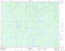
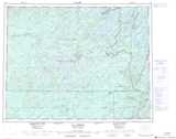
Maps showing Lac Carqueville, Baie-James; Jamésie, Quebec
Lac Carqueville is a Lake located in Baie-James; Jamésie, Quebec and has an elevation of 328 meters.
- Latitude: 50° 56' 5'' North (decimal: 50.9347222)
- Longitude: 75° 27' 42'' West (decimal: -75.4616667)
- Topography Feature Category: Lake
- Geographical Feature: Lac
- Canadian Province/Territory: Quebec
- Elevation: 328 meters
- Location: Baie-James; Jamésie
- Atlas of Canada Locator Map: Lac Carqueville
- GPS Coordinate Locator Map: Lac Carqueville Lat/Long
Lac Carqueville NTS Map Sheets