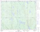
Maps showing Lac à l'Aiguille, Rivière-Mouchalagane; Caniapiscau, Quebec
Lac à l'Aiguille is a Lake located in Rivière-Mouchalagane; Caniapiscau, Quebec.
- Latitude: 51° 45' 52'' North (decimal: 51.7644886)
- Longitude: 68° 44' 15'' West (decimal: -68.7374591)
- Topography Feature Category: Lake
- Geographical Feature: Lac
- Canadian Province/Territory: Quebec
- Location: Rivière-Mouchalagane; Caniapiscau
- Atlas of Canada Locator Map: Lac à l'Aiguille
- GPS Coordinate Locator Map: Lac à l'Aiguille Lat/Long
Lac à l'Aiguille NTS Map Sheets