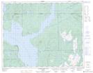
Maps showing Lac des Atocas, Rivière-Mouchalagane; Caniapiscau, Quebec
Lac des Atocas is a Lake located in Rivière-Mouchalagane; Caniapiscau, Quebec.
- Latitude: 51° 35' 15'' North (decimal: 51.5875469)
- Longitude: 68° 2' 33'' West (decimal: -68.0424743)
- Topography Feature Category: Lake
- Geographical Feature: Lac
- Canadian Province/Territory: Quebec
- Location: Rivière-Mouchalagane; Caniapiscau
- Atlas of Canada Locator Map: Lac des Atocas
- GPS Coordinate Locator Map: Lac des Atocas Lat/Long
Lac des Atocas NTS Map Sheets