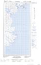
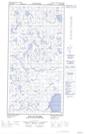
Maps showing Estran Tinujjauvik, Rivière-Koksoak; Kativik, Quebec
Estran Tinujjauvik is a Beach located in Rivière-Koksoak; Kativik, Quebec.
- Latitude: 60° 42' 4'' North (decimal: 60.7010319)
- Longitude: 69° 39' 53'' West (decimal: -69.6646064)
- Topography Feature Category: Beach
- Geographical Feature: Estran
- Canadian Province/Territory: Quebec
- Location: Rivière-Koksoak; Kativik
- Atlas of Canada Locator Map: Estran Tinujjauvik
- GPS Coordinate Locator Map: Estran Tinujjauvik Lat/Long
Estran Tinujjauvik NTS Map Sheets