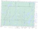
Maps showing Rapides Sâgi, Rivière-Kipawa; Témiscamingue, Quebec
Rapides Sâgi is a Rapids located in Rivière-Kipawa; Témiscamingue, Quebec.
- Latitude: 47° 40' 17'' North (decimal: 47.6714705)
- Longitude: 77° 31' 14'' West (decimal: -77.5205603)
- Topography Feature Category: Rapids
- Geographical Feature: Rapides
- Canadian Province/Territory: Quebec
- Location: Rivière-Kipawa; Témiscamingue
- Atlas of Canada Locator Map: Rapides Sâgi
- GPS Coordinate Locator Map: Rapides Sâgi Lat/Long
Rapides Sâgi NTS Map Sheets