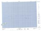
Maps showing Rocher aux Margaulx, Les Îles-de-la-Madeleine; Les Îles-de-la-Madeleine, Quebec
Rocher aux Margaulx is a Island located in Les Îles-de-la-Madeleine; Les Îles-de-la-Madeleine, Quebec and has an elevation of 0 meters.
- Latitude: 47° 50' 50'' North (decimal: 47.8472778)
- Longitude: 61° 9' 47'' West (decimal: -61.1631612)
- Topography Feature Category: Island
- Geographical Feature: Rocher
- Canadian Province/Territory: Quebec
- Elevation: 0 meters
- Location: Les Îles-de-la-Madeleine; Les Îles-de-la-Madeleine
- Atlas of Canada Locator Map: Rocher aux Margaulx
- GPS Coordinate Locator Map: Rocher aux Margaulx Lat/Long
Rocher aux Margaulx NTS Map Sheets