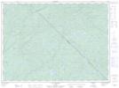
Maps showing Étang Peggy, Baie-Obaoca; Matawinie, Quebec
Étang Peggy is a Lake located in Baie-Obaoca; Matawinie, Quebec.
- Latitude: 47° 40' 4'' North (decimal: 47.6678446)
- Longitude: 74° 37' 2'' West (decimal: -74.6170908)
- Topography Feature Category: Lake
- Geographical Feature: Étang
- Canadian Province/Territory: Quebec
- Location: Baie-Obaoca; Matawinie
- Atlas of Canada Locator Map: Étang Peggy
- GPS Coordinate Locator Map: Étang Peggy Lat/Long
Étang Peggy NTS Map Sheets