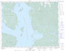
Maps showing La Porte-des-Bouleaux, Rivière-aux-Outardes; Manicouagan, Quebec
La Porte-des-Bouleaux is a Unincorporated area located in Rivière-aux-Outardes; Manicouagan, Quebec.
- Latitude: 51° 29' 3'' North (decimal: 51.4842035)
- Longitude: 68° 9' 25'' West (decimal: -68.1569223)
- Topography Feature Category: Unincorporated area
- Geographical Feature: Lieu-dit
- Canadian Province/Territory: Quebec
- Location: Rivière-aux-Outardes; Manicouagan
- Atlas of Canada Locator Map: La Porte-des-Bouleaux
- GPS Coordinate Locator Map: La Porte-des-Bouleaux Lat/Long
La Porte-des-Bouleaux NTS Map Sheets