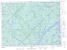
Maps showing Île du Butor, La Tuque; Le Haut-Saint-Maurice, Quebec
Île du Butor is a Island located in La Tuque; Le Haut-Saint-Maurice, Quebec.
- Latitude: 47° 52' 55'' North (decimal: 47.8819933)
- Longitude: 73° 23' 58'' West (decimal: -73.3995578)
- Topography Feature Category: Island
- Geographical Feature: Île / Ile
- Canadian Province/Territory: Quebec
- Location: La Tuque; Le Haut-Saint-Maurice
- Atlas of Canada Locator Map: Île du Butor
- GPS Coordinate Locator Map: Île du Butor Lat/Long