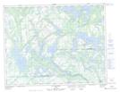
Maps showing Rivière à Dutro, Petit-Mécatina; Minganie, Quebec
Rivière à Dutro is a River located in Petit-Mécatina; Minganie, Quebec.
- Latitude: 50° 24' 10'' North (decimal: 50.4028461)
- Longitude: 61° 12' 56'' West (decimal: -61.2156228)
- Topography Feature Category: River
- Geographical Feature: Rivière
- Canadian Province/Territory: Quebec
- Location: Petit-Mécatina; Minganie
- Atlas of Canada Locator Map: Rivière à Dutro
- GPS Coordinate Locator Map: Rivière à Dutro Lat/Long
Rivière à Dutro NTS Map Sheets