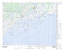
Maps showing L'Old Fort Brook, Bonne-Espérance; Basse-Côte-Nord, Quebec
L'Old Fort Brook is a River located in Bonne-Espérance; Basse-Côte-Nord, Quebec.
- Latitude: 51° 29' 41'' North (decimal: 51.4947757)
- Longitude: 57° 51' 29'' West (decimal: -57.8579710)
- Topography Feature Category: River
- Geographical Feature: Ruisseau
- Canadian Province/Territory: Quebec
- Location: Bonne-Espérance; Basse-Côte-Nord
- Atlas of Canada Locator Map: L'Old Fort Brook
- GPS Coordinate Locator Map: L'Old Fort Brook Lat/Long
L'Old Fort Brook NTS Map Sheets