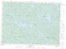
Maps showing Île Lévis, Lac-Nilgaut; Pontiac, Quebec
Île Lévis is a Island located in Lac-Nilgaut; Pontiac, Quebec.
- Latitude: 46° 24' 32'' North (decimal: 46.4089474)
- Longitude: 77° 10' 39'' West (decimal: -77.1775074)
- Topography Feature Category: Island
- Geographical Feature: Île / Ile
- Canadian Province/Territory: Quebec
- Location: Lac-Nilgaut; Pontiac
- Atlas of Canada Locator Map: Île Lévis
- GPS Coordinate Locator Map: Île Lévis Lat/Long
Île Lévis NTS Map Sheets