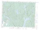
Maps showing Île du Goéland, Mont-Valin; Le Fjord-du-Saguenay, Quebec
Île du Goéland is a Island located in Mont-Valin; Le Fjord-du-Saguenay, Quebec.
- Latitude: 48° 54' 20'' North (decimal: 48.9055982)
- Longitude: 71° 16' 8'' West (decimal: -71.2689740)
- Topography Feature Category: Island
- Geographical Feature: Île / Ile
- Canadian Province/Territory: Quebec
- Location: Mont-Valin; Le Fjord-du-Saguenay
- Atlas of Canada Locator Map: Île du Goéland
- GPS Coordinate Locator Map: Île du Goéland Lat/Long
Île du Goéland NTS Map Sheets