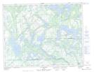
Maps showing Île aux Trembles, Côte-Nord-du-Golfe-du-Saint-Laurent; Basse-Côte-Nord, Quebec
Île aux Trembles is a Island located in Côte-Nord-du-Golfe-du-Saint-Laurent; Basse-Côte-Nord, Quebec.
- Latitude: 50° 15' 12'' North (decimal: 50.2534021)
- Longitude: 61° 5' 13'' West (decimal: -61.0870079)
- Topography Feature Category: Island
- Geographical Feature: Île / Ile
- Canadian Province/Territory: Quebec
- Location: Côte-Nord-du-Golfe-du-Saint-Laurent; Basse-Côte-Nord
- Atlas of Canada Locator Map: Île aux Trembles
- GPS Coordinate Locator Map: Île aux Trembles Lat/Long
Île aux Trembles NTS Map Sheets