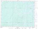
Maps showing Île Sirène, Senneterre; Vallée-de-l'Or, Quebec
Île Sirène is a Island located in Senneterre; Vallée-de-l'Or, Quebec.
- Latitude: 48° 25' 50'' North (decimal: 48.4306288)
- Longitude: 75° 40' 29'' West (decimal: -75.6746183)
- Topography Feature Category: Island
- Geographical Feature: Île / Ile
- Canadian Province/Territory: Quebec
- Location: Senneterre; Vallée-de-l'Or
- Atlas of Canada Locator Map: Île Sirène
- GPS Coordinate Locator Map: Île Sirène Lat/Long
Île Sirène NTS Map Sheets