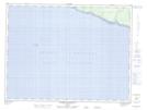
Maps showing Pointe à Chabot, L'Île-d'Anticosti; Minganie, Quebec
Pointe à Chabot is a Cape located in L'Île-d'Anticosti; Minganie, Quebec.
- Latitude: 49° 44' 10'' North (decimal: 49.7361751)
- Longitude: 64° 9' 58'' West (decimal: -64.1659995)
- Topography Feature Category: Cape
- Geographical Feature: Pointe
- Canadian Province/Territory: Quebec
- Location: L'Île-d'Anticosti; Minganie
- Atlas of Canada Locator Map: Pointe à Chabot
- GPS Coordinate Locator Map: Pointe à Chabot Lat/Long
Pointe à Chabot NTS Map Sheets