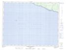
Maps showing Pointe des Algues, L'Île-d'Anticosti; Minganie, Quebec
Pointe des Algues is a Cape located in L'Île-d'Anticosti; Minganie, Quebec.
- Latitude: 49° 42' 45'' North (decimal: 49.7125640)
- Longitude: 64° 3' 43'' West (decimal: -64.0618300)
- Topography Feature Category: Cape
- Geographical Feature: Pointe
- Canadian Province/Territory: Quebec
- Location: L'Île-d'Anticosti; Minganie
- Atlas of Canada Locator Map: Pointe des Algues
- GPS Coordinate Locator Map: Pointe des Algues Lat/Long
Pointe des Algues NTS Map Sheets