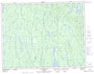
Maps showing Lac du Till, Rivière-Mistassini; Maria-Chapdelaine, Quebec
Lac du Till is a Lake located in Rivière-Mistassini; Maria-Chapdelaine, Quebec.
- Latitude: 50° 2' 16'' North (decimal: 50.0378439)
- Longitude: 73° 20' 17'' West (decimal: -73.3381879)
- Topography Feature Category: Lake
- Geographical Feature: Lac
- Canadian Province/Territory: Quebec
- Location: Rivière-Mistassini; Maria-Chapdelaine
- Atlas of Canada Locator Map: Lac du Till
- GPS Coordinate Locator Map: Lac du Till Lat/Long
Lac du Till NTS Map Sheets