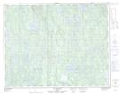
Maps showing Île en U, Lac-Jérôme; Minganie, Quebec
Île en U is a Island located in Lac-Jérôme; Minganie, Quebec.
- Latitude: 50° 33' 17'' North (decimal: 50.5547902)
- Longitude: 62° 28' 3'' West (decimal: -62.4676083)
- Topography Feature Category: Island
- Geographical Feature: Île / Ile
- Canadian Province/Territory: Quebec
- Location: Lac-Jérôme; Minganie
- Atlas of Canada Locator Map: Île en U
- GPS Coordinate Locator Map: Île en U Lat/Long
Île en U NTS Map Sheets