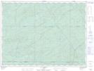
Maps showing Lac de l'Aigle Noir, La Tuque; Le Haut-Saint-Maurice, Quebec
Lac de l'Aigle Noir is a Lake located in La Tuque; Le Haut-Saint-Maurice, Quebec.
- Latitude: 47° 46' 15'' North (decimal: 47.7709062)
- Longitude: 75° 18' 19'' West (decimal: -75.3051644)
- Topography Feature Category: Lake
- Geographical Feature: Lac
- Canadian Province/Territory: Quebec
- Location: La Tuque; Le Haut-Saint-Maurice
- Atlas of Canada Locator Map: Lac de l'Aigle Noir
- GPS Coordinate Locator Map: Lac de l'Aigle Noir Lat/Long
Lac de l'Aigle Noir NTS Map Sheets