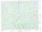
Maps showing Lac Armand, Rivière-aux-Outardes; Manicouagan, Quebec
Lac Armand is a Lake located in Rivière-aux-Outardes; Manicouagan, Quebec.
- Latitude: 50° 38' 25'' North (decimal: 50.6402887)
- Longitude: 67° 52' 22'' West (decimal: -67.8728213)
- Topography Feature Category: Lake
- Geographical Feature: Lac
- Canadian Province/Territory: Quebec
- Location: Rivière-aux-Outardes; Manicouagan
- Atlas of Canada Locator Map: Lac Armand
- GPS Coordinate Locator Map: Lac Armand Lat/Long
Lac Armand NTS Map Sheets