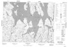
Maps showing Lac à Découvert, Chute-des-Passes; Maria-Chapdelaine, Quebec
Lac à Découvert is a Lake located in Chute-des-Passes; Maria-Chapdelaine, Quebec.
- Latitude: 50° 32' 30'' North (decimal: 50.5417397)
- Longitude: 70° 37' 58'' West (decimal: -70.6328581)
- Topography Feature Category: Lake
- Geographical Feature: Lac
- Canadian Province/Territory: Quebec
- Location: Chute-des-Passes; Maria-Chapdelaine
- Atlas of Canada Locator Map: Lac à Découvert
- GPS Coordinate Locator Map: Lac à Découvert Lat/Long
Lac à Découvert NTS Map Sheets