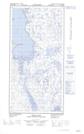
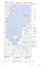
Maps showing Chenal Iggiajaaq, Rivière-Koksoak; Kativik, Quebec
Chenal Iggiajaaq is a Channel located in Rivière-Koksoak; Kativik, Quebec.
- Latitude: 60° 50' 15'' North (decimal: 60.8374394)
- Longitude: 69° 51' 45'' West (decimal: -69.8623656)
- Topography Feature Category: Channel
- Geographical Feature: Chenal
- Canadian Province/Territory: Quebec
- Location: Rivière-Koksoak; Kativik
- Atlas of Canada Locator Map: Chenal Iggiajaaq
- GPS Coordinate Locator Map: Chenal Iggiajaaq Lat/Long
Chenal Iggiajaaq NTS Map Sheets