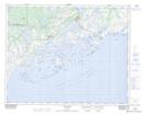
Maps showing Le Bob-Bilven Pond, Bonne-Espérance; Basse-Côte-Nord, Quebec
Le Bob-Bilven Pond is a Lake located in Bonne-Espérance; Basse-Côte-Nord, Quebec.
- Latitude: 51° 24' 16'' North (decimal: 51.4044990)
- Longitude: 57° 59' 20'' West (decimal: -57.9888082)
- Topography Feature Category: Lake
- Geographical Feature: Étang
- Canadian Province/Territory: Quebec
- Location: Bonne-Espérance; Basse-Côte-Nord
- Atlas of Canada Locator Map: Le Bob-Bilven Pond
- GPS Coordinate Locator Map: Le Bob-Bilven Pond Lat/Long
Le Bob-Bilven Pond NTS Map Sheets