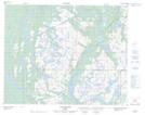
Maps showing Le Bob's Pond, Petit-Mécatina; Minganie, Quebec
Le Bob's Pond is a Lake located in Petit-Mécatina; Minganie, Quebec.
- Latitude: 51° 32' 40'' North (decimal: 51.5444980)
- Longitude: 57° 59' 4'' West (decimal: -57.9843602)
- Topography Feature Category: Lake
- Geographical Feature: Étang
- Canadian Province/Territory: Quebec
- Location: Petit-Mécatina; Minganie
- Atlas of Canada Locator Map: Le Bob's Pond
- GPS Coordinate Locator Map: Le Bob's Pond Lat/Long
Le Bob's Pond NTS Map Sheets