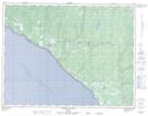
Maps showing L'Épave-Fayette-Brown, L'Île-d'Anticosti; Minganie, Quebec
L'Épave-Fayette-Brown is a Unincorporated area located in L'Île-d'Anticosti; Minganie, Quebec.
- Latitude: 49° 35' 53'' North (decimal: 49.5981221)
- Longitude: 63° 46' 52'' West (decimal: -63.7809847)
- Topography Feature Category: Unincorporated area
- Geographical Feature: Lieu-dit
- Canadian Province/Territory: Quebec
- Location: L'Île-d'Anticosti; Minganie
- GPS Coordinate Locator Map: L'Épave-Fayette-Brown Lat/Long
L'Épave-Fayette-Brown NTS Map Sheets