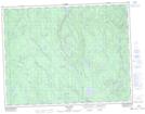
Maps showing Lac du Moulin, Rivière-Mistassini; Maria-Chapdelaine, Quebec
Lac du Moulin is a Lake located in Rivière-Mistassini; Maria-Chapdelaine, Quebec.
- Latitude: 49° 42' 25'' North (decimal: 49.7070061)
- Longitude: 72° 17' 28'' West (decimal: -72.2911968)
- Topography Feature Category: Lake
- Geographical Feature: Lac
- Canadian Province/Territory: Quebec
- Location: Rivière-Mistassini; Maria-Chapdelaine
- Atlas of Canada Locator Map: Lac du Moulin
- GPS Coordinate Locator Map: Lac du Moulin Lat/Long
Lac du Moulin NTS Map Sheets