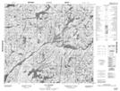
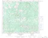
Maps showing Lac Shirley, Rivière-Koksoak; Kativik, Quebec
Lac Shirley is a Lake located in Rivière-Koksoak; Kativik, Quebec.
- Latitude: 55° 36' 55'' North (decimal: 55.6153999)
- Longitude: 69° 8' 4'' West (decimal: -69.1343645)
- Topography Feature Category: Lake
- Geographical Feature: Lac
- Canadian Province/Territory: Quebec
- Location: Rivière-Koksoak; Kativik
- Atlas of Canada Locator Map: Lac Shirley
- GPS Coordinate Locator Map: Lac Shirley Lat/Long
Lac Shirley NTS Map Sheets