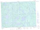
Maps showing Lac du Feu, Rivière-Kipawa; Témiscamingue, Quebec
Lac du Feu is a Lake located in Rivière-Kipawa; Témiscamingue, Quebec.
- Latitude: 47° 9' 6'' North (decimal: 47.1517312)
- Longitude: 78° 27' 58'' West (decimal: -78.4661767)
- Topography Feature Category: Lake
- Geographical Feature: Lac
- Canadian Province/Territory: Quebec
- Location: Rivière-Kipawa; Témiscamingue
- Atlas of Canada Locator Map: Lac du Feu
- GPS Coordinate Locator Map: Lac du Feu Lat/Long
Lac du Feu NTS Map Sheets