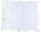
Maps showing Îles Harbour, Gros-Mécatina; Basse-Côte-Nord, Quebec
Îles Harbour is a Island located in Gros-Mécatina; Basse-Côte-Nord, Quebec.
- Latitude: 50° 48' 25'' North (decimal: 50.8069997)
- Longitude: 58° 50' 15'' West (decimal: -58.8374538)
- Topography Feature Category: Island
- Geographical Feature: Îles / Iles
- Canadian Province/Territory: Quebec
- Location: Gros-Mécatina; Basse-Côte-Nord
- Atlas of Canada Locator Map: Îles Harbour
- GPS Coordinate Locator Map: Îles Harbour Lat/Long
Îles Harbour NTS Map Sheets