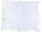
Maps showing Le Middle Berth, Gros-Mécatina; Basse-Côte-Nord, Quebec
Le Middle Berth is a Bay located in Gros-Mécatina; Basse-Côte-Nord, Quebec.
- Latitude: 50° 46' 53'' North (decimal: 50.7814442)
- Longitude: 58° 51' 35'' West (decimal: -58.8596772)
- Topography Feature Category: Bay
- Geographical Feature: Mouillage
- Canadian Province/Territory: Quebec
- Location: Gros-Mécatina; Basse-Côte-Nord
- Atlas of Canada Locator Map: Le Middle Berth
- GPS Coordinate Locator Map: Le Middle Berth Lat/Long
Le Middle Berth NTS Map Sheets