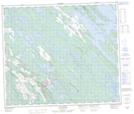
Maps showing Lac John Indian Reserve, Lac John; Caniapiscau, Quebec
Lac John Indian Reserve is a Indian Reserve located in Lac John; Caniapiscau, Quebec.
- Latitude: 54° 49' North (decimal: 54.816667)
- Longitude: 66° 47' West (decimal: -66.7833328)
- Topography Feature Category: Indian Reserve
- Geographical Feature: Indian Reserve
- Canadian Province/Territory: Quebec
- Location: Lac John; Caniapiscau
- Atlas of Canada Locator Map: Lac John Indian Reserve
- GPS Coordinate Locator Map: Lac John Indian Reserve Lat/Long
Lac John Indian Reserve NTS Map Sheets