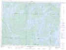
Maps showing Réserve indienne Rapid Lake, Rapid Lake; La Vallée-de-la-Gatineau, Quebec
Réserve indienne Rapid Lake is a Indian Reserve located in Rapid Lake; La Vallée-de-la-Gatineau, Quebec and has an elevation of 361 meters.
- Latitude: 47° 15' North (decimal: 47.2499998)
- Longitude: 76° 42' West (decimal: -76.7)
- Topography Feature Category: Indian Reserve
- Geographical Feature: Réserve indienne
- Canadian Province/Territory: Quebec
- Elevation: 361 meters
- Location: Rapid Lake; La Vallée-de-la-Gatineau
- Atlas of Canada Locator Map: Réserve indienne Rapid Lake
- GPS Coordinate Locator Map: Réserve indienne Rapid Lake Lat/Long
Réserve indienne Rapid Lake NTS Map Sheets