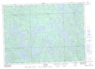
Maps showing Lac de la Sturnelle, Rivière-Kipawa; Témiscamingue, Quebec
Lac de la Sturnelle is a Lake located in Rivière-Kipawa; Témiscamingue, Quebec.
- Latitude: 46° 33' 7'' North (decimal: 46.5520026)
- Longitude: 78° 5' 54'' West (decimal: -78.0983727)
- Topography Feature Category: Lake
- Geographical Feature: Lac
- Canadian Province/Territory: Quebec
- Location: Rivière-Kipawa; Témiscamingue
- Atlas of Canada Locator Map: Lac de la Sturnelle
- GPS Coordinate Locator Map: Lac de la Sturnelle Lat/Long