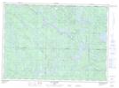
Maps showing Rapide-du-Cheval-Blanc, Lac-Marguerite; Antoine-Labelle, Quebec
Rapide-du-Cheval-Blanc is a Unincorporated area located in Lac-Marguerite; Antoine-Labelle, Quebec.
- Latitude: 46° 51' 6'' North (decimal: 46.8517259)
- Longitude: 75° 55' 29'' West (decimal: -75.9246593)
- Topography Feature Category: Unincorporated area
- Geographical Feature: Lieu-dit
- Canadian Province/Territory: Quebec
- Location: Lac-Marguerite; Antoine-Labelle
- Atlas of Canada Locator Map: Rapide-du-Cheval-Blanc
- GPS Coordinate Locator Map: Rapide-du-Cheval-Blanc Lat/Long
Rapide-du-Cheval-Blanc NTS Map Sheets