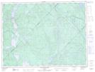
Maps showing Baie Usher, La Tuque; Le Haut-Saint-Maurice, Quebec
Baie Usher is a Bay located in La Tuque; Le Haut-Saint-Maurice, Quebec.
- Latitude: 47° 32' 15'' North (decimal: 47.5375503)
- Longitude: 73° 41' 41'' West (decimal: -73.6948491)
- Topography Feature Category: Bay
- Geographical Feature: Baie
- Canadian Province/Territory: Quebec
- Location: La Tuque; Le Haut-Saint-Maurice
- Atlas of Canada Locator Map: Baie Usher
- GPS Coordinate Locator Map: Baie Usher Lat/Long
Baie Usher NTS Map Sheets