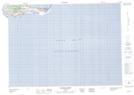
Maps showing L'Ancien-Quai, Les Îles-de-la-Madeleine; Les Îles-de-la-Madeleine, Quebec
L'Ancien-Quai is a Unincorporated area located in Les Îles-de-la-Madeleine; Les Îles-de-la-Madeleine, Quebec.
- Latitude: 47° 14' 22'' North (decimal: 47.2395138)
- Longitude: 61° 50' 7'' West (decimal: -61.8353924)
- Topography Feature Category: Unincorporated area
- Geographical Feature: Lieu-dit
- Canadian Province/Territory: Quebec
- Location: Les Îles-de-la-Madeleine; Les Îles-de-la-Madeleine
- Atlas of Canada Locator Map: L'Ancien-Quai
- GPS Coordinate Locator Map: L'Ancien-Quai Lat/Long
L'Ancien-Quai NTS Map Sheets