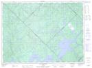
Maps showing Lac des Canots Perdus, Baie-Obaoca; Matawinie, Quebec
Lac des Canots Perdus is a Lake located in Baie-Obaoca; Matawinie, Quebec.
- Latitude: 47° 37' 50'' North (decimal: 47.6306205)
- Longitude: 74° 27' 49'' West (decimal: -74.4634766)
- Topography Feature Category: Lake
- Geographical Feature: Lac
- Canadian Province/Territory: Quebec
- Location: Baie-Obaoca; Matawinie
- Atlas of Canada Locator Map: Lac des Canots Perdus
- GPS Coordinate Locator Map: Lac des Canots Perdus Lat/Long
Lac des Canots Perdus NTS Map Sheets