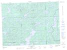
Maps showing Baie Lebrun, Rivière-Kipawa; Témiscamingue, Quebec
Baie Lebrun is a Bay located in Rivière-Kipawa; Témiscamingue, Quebec.
- Latitude: 47° 17' 54'' North (decimal: 47.2984012)
- Longitude: 78° 29' 24'' West (decimal: -78.4900700)
- Topography Feature Category: Bay
- Geographical Feature: Baie
- Canadian Province/Territory: Quebec
- Location: Rivière-Kipawa; Témiscamingue
- Atlas of Canada Locator Map: Baie Lebrun
- GPS Coordinate Locator Map: Baie Lebrun Lat/Long
Baie Lebrun NTS Map Sheets